![]()
When planning a trip to northern Morocco, few tools are as helpful as a Morocco Tangier map. Tangier, often called the “Gateway to Africa,” sits proudly at the meeting point of the Atlantic Ocean and the Mediterranean Sea. With its rich history, vibrant souks, and unique cultural blend, it’s easy to see why Tangier is a must-visit destination. A map not only guides you through the winding medina streets but also helps you discover hidden gems, from seaside cafés to historic kasbahs. In this guide, we’ll explore Tangier using the map as your compass to adventure.
Tangier: An Overview of Morocco’s Northern Jewel
A Historic Port City
Located at the crossroads of Europe and Africa, Tangier has long been a cultural melting pot. According to Wikipedia, the city’s history stretches back to the Phoenicians and Romans, later becoming a hub for international diplomacy and artistic inspiration in the 20th century.
Why a Map Matters
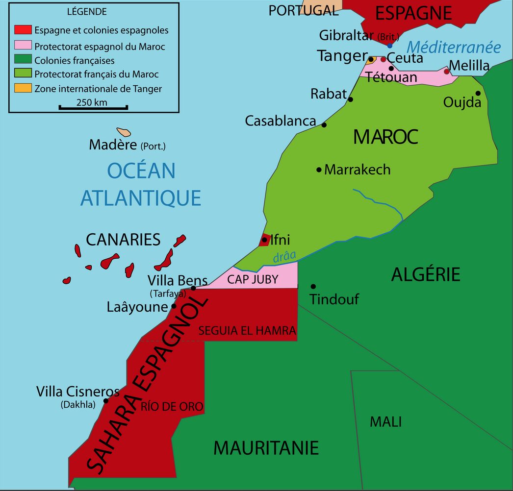
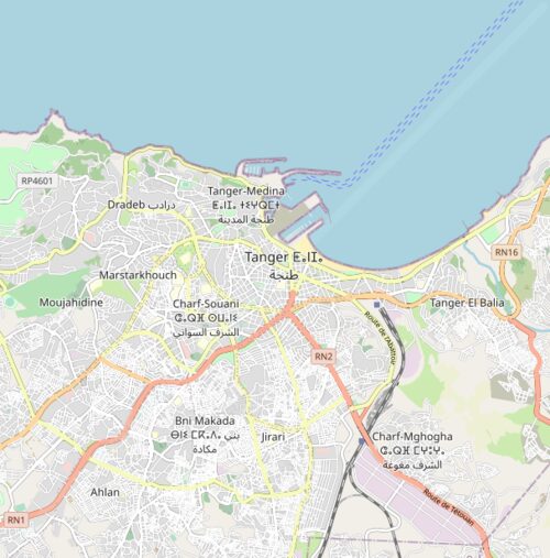
A Morocco Tangier map is essential because the city is divided into distinct areas: the Medina, Ville Nouvelle (new town), and coastal promenades. Each district offers a different experience—from traditional souks and kasbah walls to modern cafés overlooking the sea. Having a map helps travelers connect the dots between these contrasting zones.
Must-See Attractions on the Morocco Tangier Map
The Medina and Kasbah
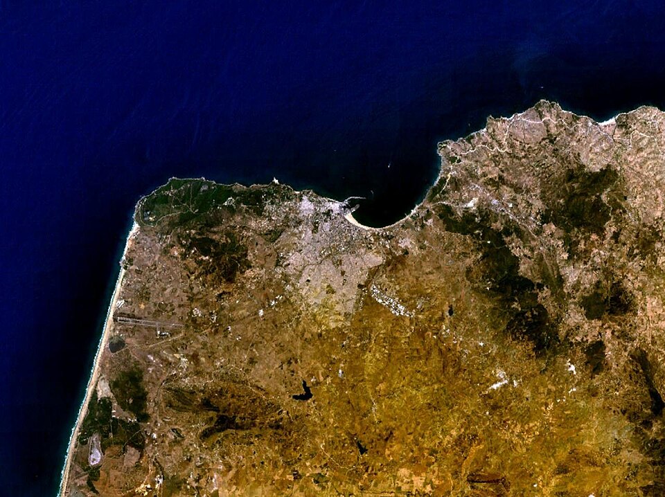
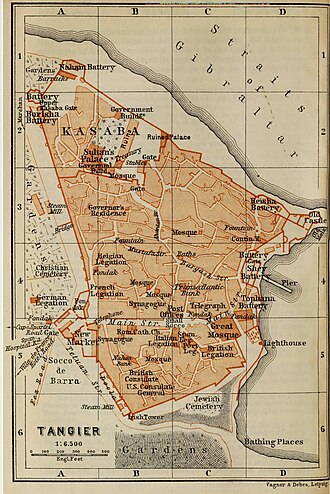
At the heart of Tangier lies the old Medina, a maze of narrow alleys filled with souks, artisan shops, and vibrant street life. The Kasbah of Tangier offers panoramic views of the Strait of Gibraltar and is marked on any reliable Morocco Tangier map.
Cap Spartel and the Caves of Hercules
To the west, about 14 km from Tangier, you’ll find Cap Spartel, where the Atlantic and Mediterranean meet. Nearby, the Caves of Hercules are a legendary site steeped in myth, believed to be where Hercules rested during his labors.
The Grand Socco and Petit Socco
Central to Tangier’s culture, the Grand Socco (a lively square) and the Petit Socco in the Medina are bustling landmarks that help orient you as you navigate with a map. They’re also perfect for people-watching with a mint tea in hand.
Tangier American Legation Museum
As the first American public property abroad, the Tangier American Legation is a unique stop on the Morocco Tangier map. It showcases Morocco’s historic role as the first country to recognize U.S. independence.
Travel Tips and Cultural Insights
Navigating with a Map
Digital tools like Google Maps make it easier to explore Tangier, but don’t underestimate the charm of a paper Morocco Tangier map, especially when the Medina’s narrow lanes confuse GPS signals.
Language and Culture
Tangier is a city of languages—Arabic, French, Spanish, and English are widely spoken. A map can often serve as a universal communication tool, especially when asking locals for directions.
Money and Transport
Coins and small notes of the Moroccan dirham are useful in Tangier, particularly when hopping into small taxis or buying street food. Keep your map handy to negotiate fair taxi fares by showing exact locations.
Real-World Traveler Stories
Many travelers say that getting lost is part of Tangier’s charm. A backpacker once described how a paper Morocco Tangier map saved them after their phone died. They discovered a hidden riad near the Kasbah simply by following the map’s landmarks.
Another traveler shared that using a Tangier map to explore off-the-beaten-path areas led them to a tiny artisan shop where they purchased handmade carpets at a fraction of the tourist price.
Future Travel Recommendations and Seasonal Insights
Best Time to Visit
The ideal time to explore Tangier is spring (April–May) or autumn (September–October), when the weather is pleasant for long walks. Having a Morocco Tangier map during these seasons helps travelers comfortably explore both coastal and inland attractions.
Exploring Beyond Tangier
Your map will also highlight connections to other Moroccan cities. From Tangier, trains and highways link you to Chefchaouen, Fes, and Marrakech. Many travelers begin in Tangier before venturing deeper into Morocco.
Sustainable Travel Tip
Using a physical map rather than always relying on your phone reduces your need for constant charging and helps you immerse yourself in the present moment—something many eco-conscious travelers value.
FAQ – Morocco Tangier Map
What is the best map to use in Tangier?
Both Google Maps and traditional paper maps are useful. For the Medina, a paper Morocco Tangier map can be more reliable.
Can I find free maps in Tangier?
Yes, many hotels, hostels, and tourist information centers offer free Morocco Tangier maps for visitors.
Is Tangier walkable with a map?
Absolutely! The Medina and central areas are walkable, though a map helps when navigating the winding streets.
Do locals help if I show them a map?
Yes, Tangier locals are generally very helpful. Showing a map often makes it easier to get directions.
Can I use Tangier maps offline?
Yes, apps like Google Maps allow you to download offline versions of the city map for convenient navigation.
Conclusion
Exploring Tangier is a journey into Morocco’s cultural crossroads, and a Morocco Tangier map is your key to unlocking its treasures. From the bustling souks of the Medina to the serene views at Cap Spartel, a map ensures you won’t miss a thing. Whether you prefer digital tools or the timeless charm of paper maps, Tangier invites you to wander, discover, and immerse yourself in its rich history.
So pack your bags, grab your map, and let Tangier be your gateway to the wonders of Morocco.


